Shimanami Kaido Map - Cycling Route by Stage, With GPX
Every bridge, bike terminal and roadside station on the Shimanami Kaido, placed at its km from Onomichi, with our GPX of the blue line to download.
Quick links
Don't want to read all this?
We've planned 800+ cycling trips. Send your dates, fitness and group size — we'll map the route and book every night.


The blue line painted on the Shimanami Kaido shows you the way to Imabari. What it cannot show is that the bike terminal on Innoshima sits 4 km off it, that seven of the ten terminals shut at 17:00, or that the longest climb away from the bridges is on Ōshima.
So we put it all on one map. Every km on this page comes from our GPX, traced on the blue line from the entrance of Onomichi Station to Imabari Station, 74.2 km in all. For the days, the seasons and where to sleep, read our Shimanami Kaido cycling guide.
Shimanami Kaido cycling route map
Zoom in before you book anything: the three stages have a colour each, and a tap on a bike terminal shows its km and opening hours.
Download our GPX for free, with no account to open: Shimanami Kaido GPX, Onomichi Station to Imabari Station. Load it into Komoot, Strava, Ride with GPS or a bike computer while you are on hotel Wi-Fi, and it will keep working offline.
On every map here, orange marks the bridge decks, and the blue bike terminals carry the numbers Shimanami Japan uses. The black line at the start is the ferry across the Onomichi Channel.
Km by km from Onomichi
Plan the stops from this table. The km run from Onomichi Station, the same way the stage maps read.
Km | Place | What's there |
0 | Onomichi Station | Bike terminal 1, convenience stores |
0.7 | Onomichi pier | Ferry to Mukaishima, a few minutes |
1.3 | Mukaishima | Bike terminal 2 |
7.7 | Innoshima Bridge | 1,270 m deck |
15 to 21 | Innoshima | Convenience stores |
19.4 | Ikuchi Bridge | 790 m deck |
27.4 | Setoda, Ikuchijima | Bike terminal 4, shops, end of stage 1 |
31.4 | Setoda Sunset Beach | Bike terminal 5, toilets |
34.6 | Tatara Bridge | 1,480 m deck, into Ehime |
37.1 | Tatara Shimanami Park, Ōmishima | Bike terminal 6, roadside station |
43.5 | Ōmishima Bridge | 328 m arch |
47.0 | Hakata S.C. Park, Hakatajima | Bike terminal 7, roadside station, end of stage 2 |
48.5 | Hakata-Ōshima Bridge | Two spans over Michika |
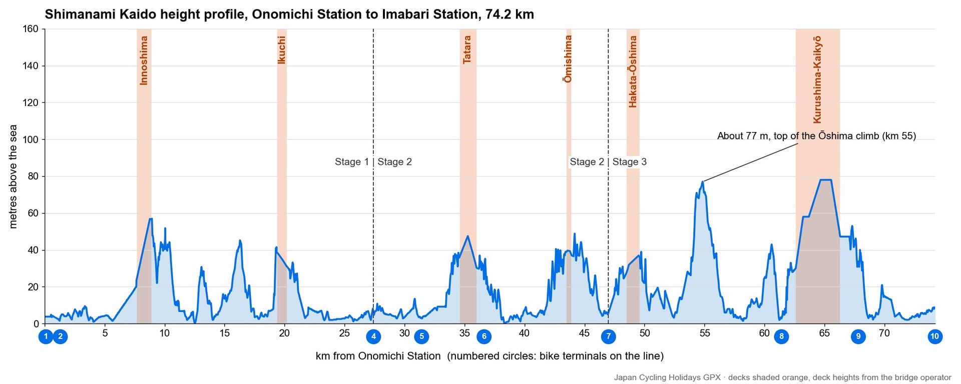
54.8 | Ōshima | Top of the island's climb, about 77 m |
57.6 | Ōshima | Convenience stores |
61.4 | Yoshiumi Ikiiki-kan, Ōshima | Bike terminal 8, roadside station |
62.6 | Kurushima-Kaikyō Bridge | Three spans, about 4 km |
67.8 | Sunrise Itoyama, Imabari | Bike terminal 9 |
74.2 | Imabari Station | Bike terminal 10, end of stage 3 |
Three stages, three maps
We cut the route at Setoda and on Hakatajima because a terminal sits right on the line at both, so every stage ends where you can hand a bike back.
Stage 1: Onomichi to Setoda, 27 km
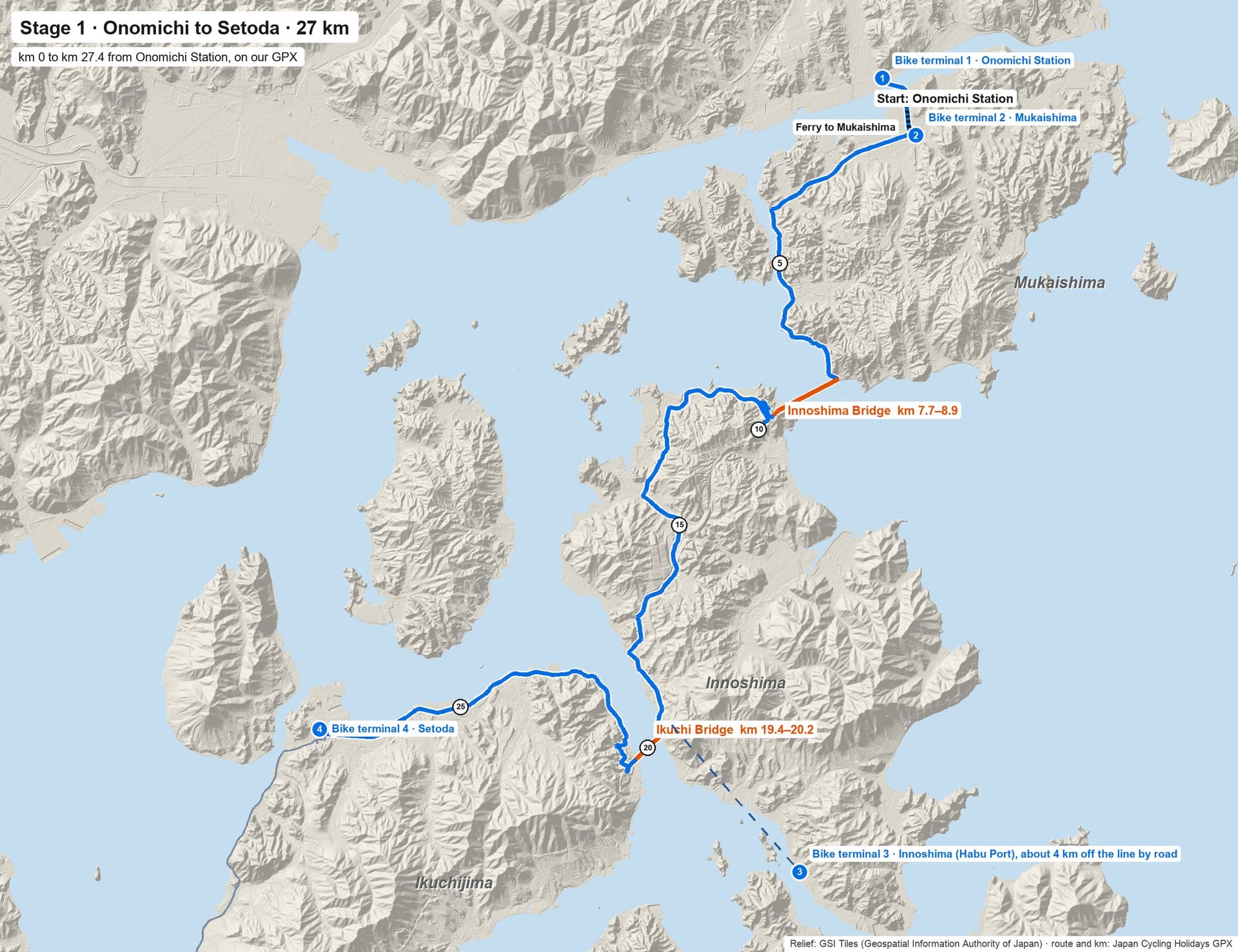
The ride starts with a boat: one of two short ferry lines takes you over to Mukaishima, and the line picks up at the pier. Mukaishima is flat and quiet. At km 7.7 a ramp lifts you onto the Innoshima Bridge, whose bike path hangs below the motorway.
Innoshima has the stage's shops, between km 15 and 21. Its terminal is at Habu Port, about 4 km south of the line by road, so there is no terminal on the line between km 1.3 and Setoda. Kōsan-ji temple stands beside the line at km 27.7.
Stage 2: Setoda to Hakatajima, 20 km
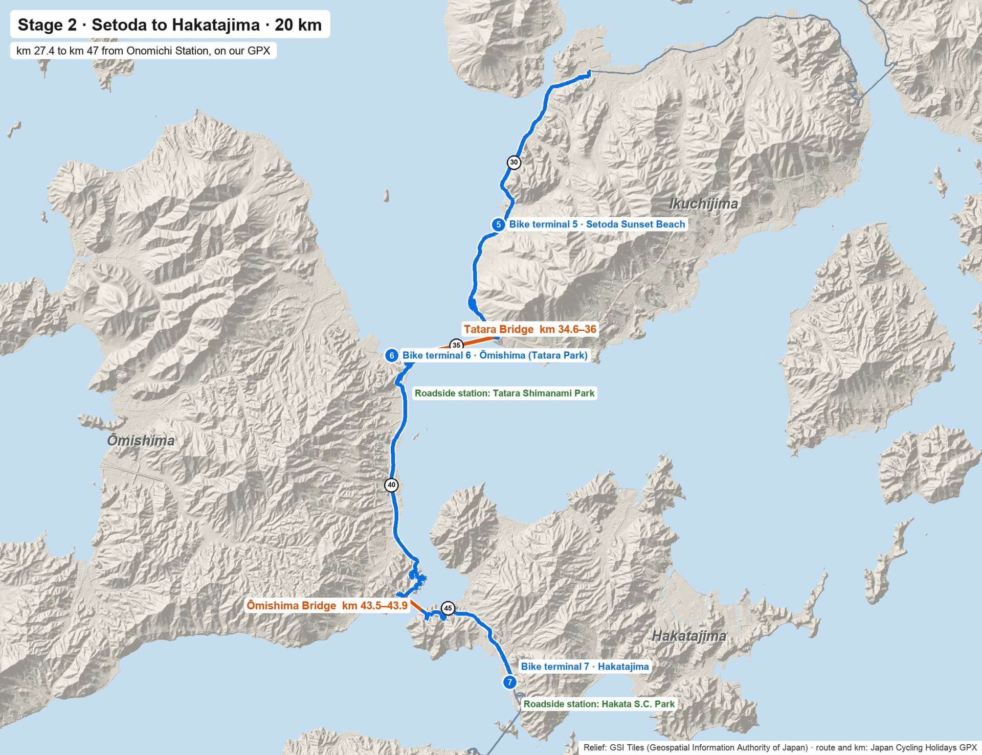
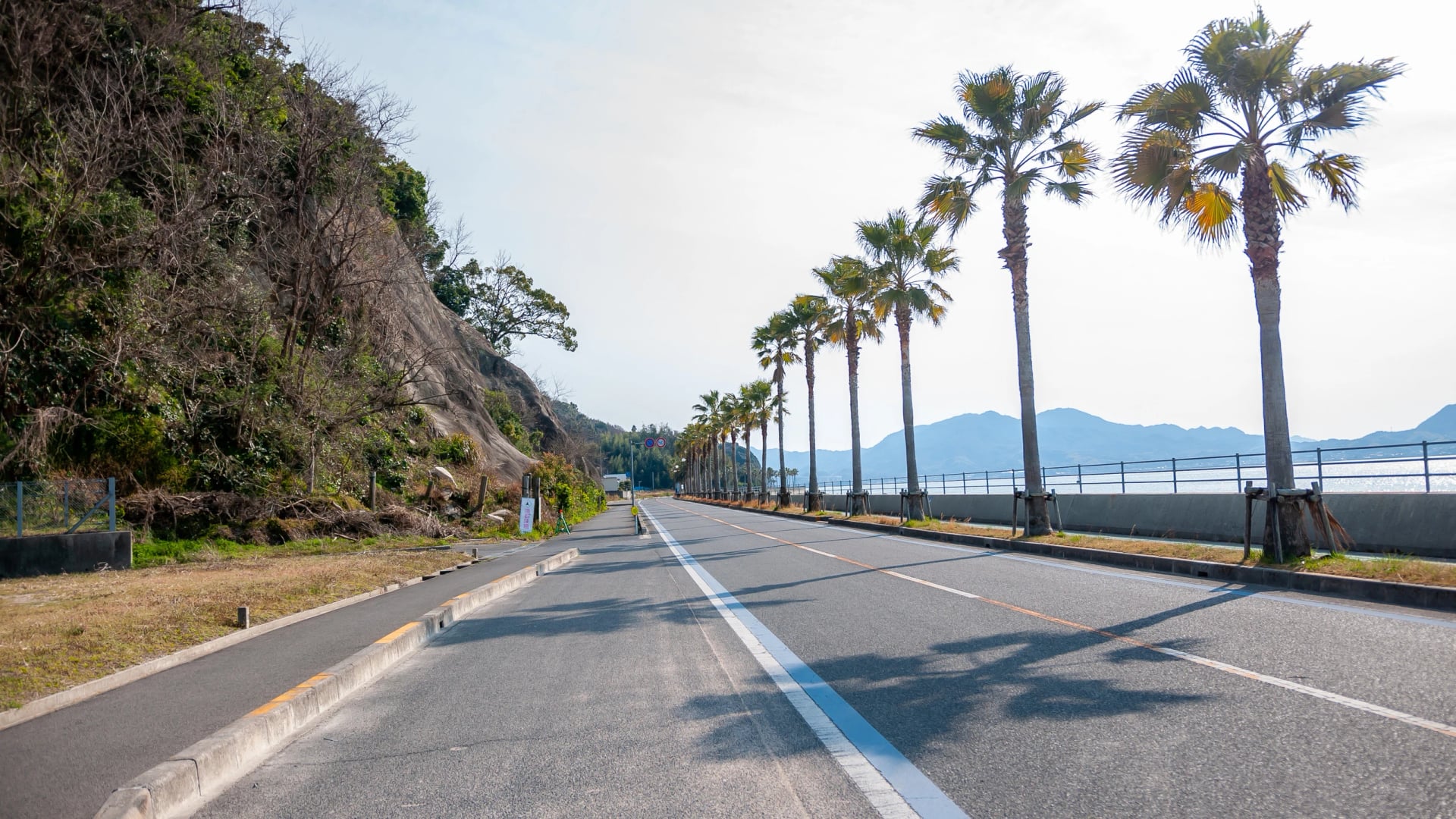
Setoda to Hakatajima is the shortest stage, and it carries the biggest bridge: past the beach terminal at km 31.4, the Tatara Bridge takes you to Ōmishima and into Ehime prefecture. Tatara Shimanami Park, at its foot, is the stop to plan for, with a roadside station, terminal 6 and the Cyclists' Sanctuary monument. Ōyamazumi Shrine is 7 km west of it by road. The Ōmishima Bridge's short arch follows at km 43.5; Hakatajima's terminal and roadside station wait at km 47.
Stage 3: Hakatajima to Imabari, 27 km
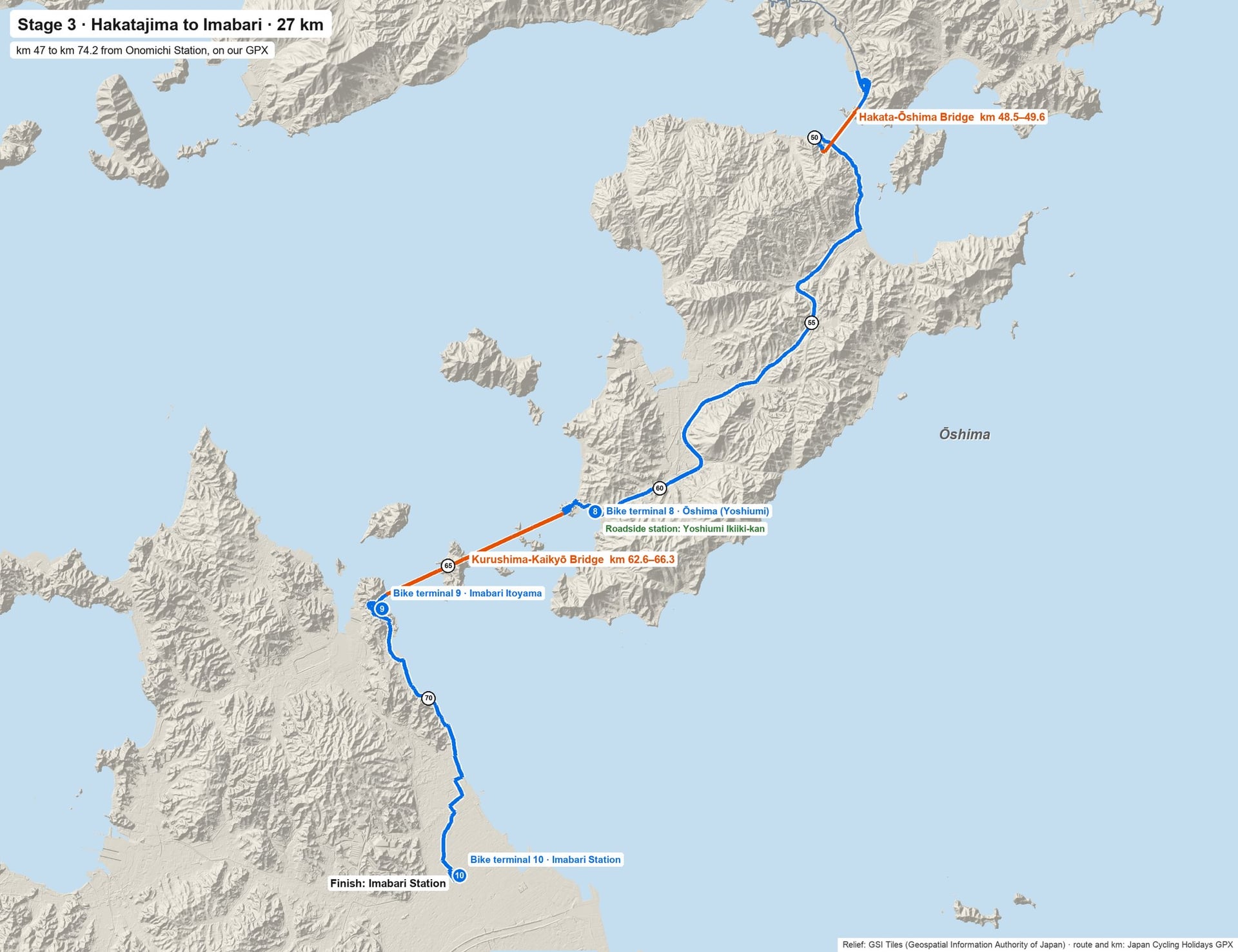
Ōshima is the longest island on the line, and it holds the one real climb. The road climbs to about 77 m near km 55; the convenience stores come after it, at km 58.
At Yoshiumi Ikiiki-kan, km 61.4, a roadside station grills seafood beside terminal 8. The Kirōsan lookout is about 5 km away by road, with some 300 m to climb.
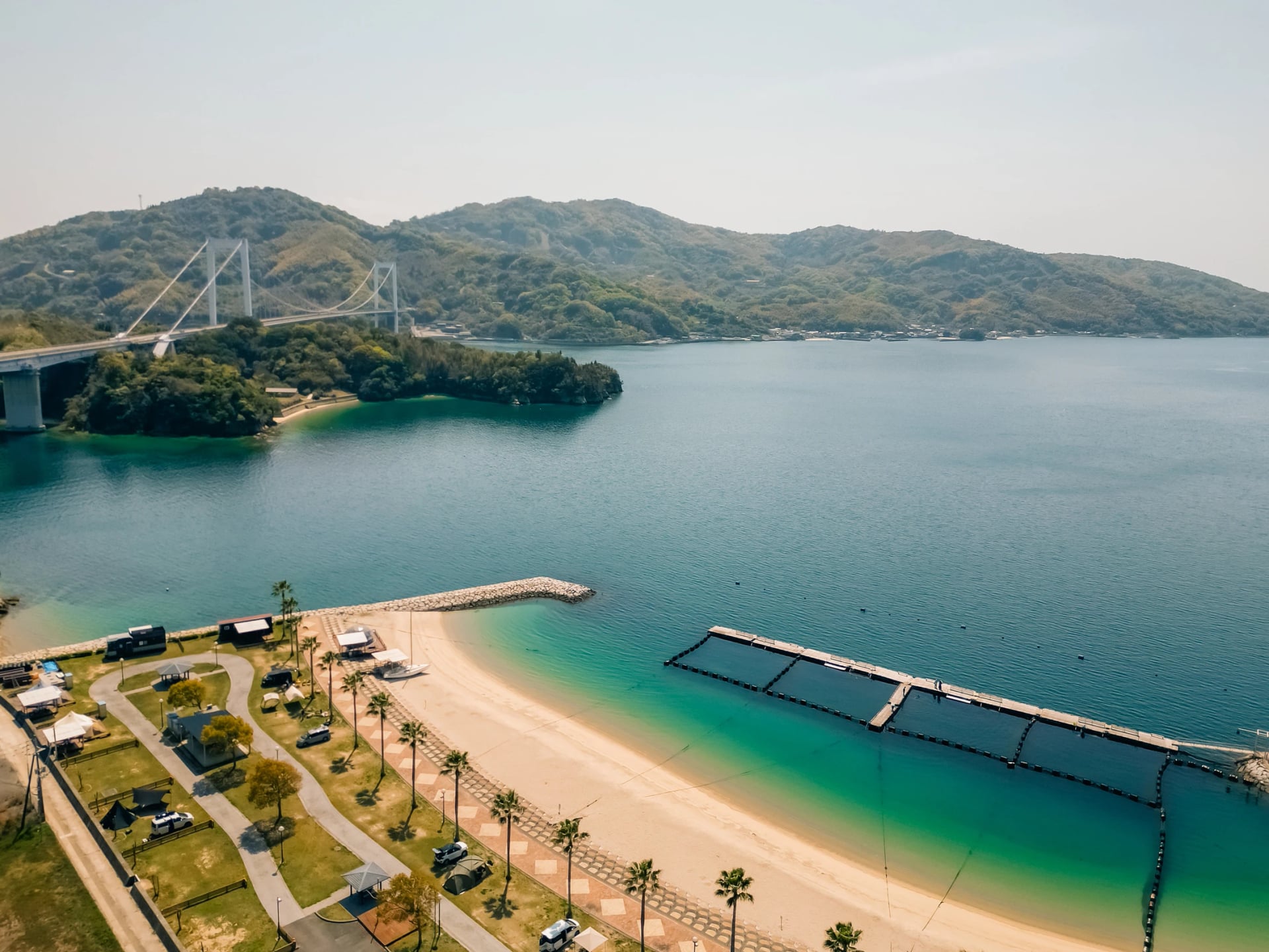
Then the Kurushima-Kaikyō Bridge: three suspension spans, about 4 km end to end, to Shikoku. Terminal 9 waits at Sunrise Itoyama, and the last 6 km follow city streets to Imabari Station.
Where the bridges are
Lengths and heights are the bridge operator's. The km show where our GPX meets each deck.
Bridge | On the deck (km) | Length, height above the sea |
Innoshima | 7.7 to 8.9 | 1,270 m; path 58 m |
Ikuchi | 19.4 to 20.2 | 790 m; 35 m |
Tatara | 34.6 to 36.0 | 1,480 m; 48 m |
Ōmishima | 43.5 to 43.9 | 328 m; 41 m |
Hakata-Ōshima | 48.5 to 49.6 | 325 m and 840 m; 34 and 39 m |
Kurushima-Kaikyō | 62.6 to 66.3 | 960, 1,515 and 1,570 m; up to 78 m |
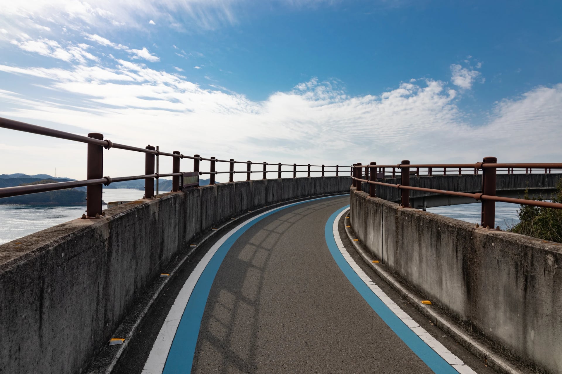
Each deck is reached by a ramp from the island road, marked with the blue line. The ramps hold most of the climbing, and the steepest climbs to the Tatara Bridge from Setoda.
Two places on the decks are made for stopping. The Kurushima-Kaikyō Bridge has two rest bays built out over the sea, and a lift down to Umashima island at km 64.7. Below a main tower of the Tatara Bridge, a pair of wooden clappers lets you hear your clap echo back off the steel.
Where to pick up and return a bike
If you hire, plan the day around these ten points. They are the only places a Shimanami Japan bike can go back, apart from a few hotels in Imabari that take their own guests' bikes.
Terminal | Km | Open |
1 Onomichi Station | 0 | 8:00 to 19:00 |
2 Mukaishima | 1.3 | 9:00 to 17:00 |
3 Innoshima, Habu Port | 4 km off the line at km 19 | 9:00 to 17:00 |
4 Setoda Tourist Information | 27.4 | 9:00 to 17:00 |
5 Setoda Sunset Beach | 31.4 | 9:00 to 17:00 |
6 Ōmishima, Tatara Shimanami Park | 37.1 | 9:00 to 17:00 |
7 Hakatajima, Hakata S.C. Park | 47.0 | 9:00 to 17:00 |
8 Ōshima, Yoshiumi Ikiiki-kan | 61.4 | 9:00 to 17:00 |
9 Imabari Itoyama | 67.8 | 8:00 to 19:00 |
10 Imabari Station | 74.2 | 8:00 to 19:00 |
From December to February, terminals 1, 9 and 10 close at 18:00.
Cross bikes and city bikes go back at any terminal, the same day or days later. Battery-assisted bikes do too, though only six terminals hand them out. The sportier e-bikes are one-day hires, returned at any terminal, and tandems go back where they started. Shimanami Japan lists the bikes and terminals on its rental page.
After 17:00 only Itoyama and Imabari Station are open, so a one-day rider running late has to make Imabari, and a late return costs extra.
Rest stops, toilets and water
Three roadside stations sit on the line: Tatara Shimanami Park on Ōmishima at km 37, Hakata S.C. Park on Hakatajima at km 47 and Yoshiumi Ikiiki-kan on Ōshima at km 61. Japan's roadside stations, the michi-no-eki, keep their toilets open day and night, and each of these three sells food. A fourth, Shimanami-no-eki Mishima, stands by Ōyamazumi Shrine.
Between them, look for the Cycle Oasis sign on shops and houses. Onomichi's 2026 cycling map describes a Cycle Oasis as a stop with a bike stand, an air pump and a toilet.
Convenience stores gather in the towns: Onomichi, Innoshima, Setoda, Hakatajima, Ōshima and Imabari. No convenience store stands on the line from km 2 to km 15, so fill your bottles in Onomichi.
Official maps worth downloading
Two printed maps earn a place next to the GPX on your phone.
Shimanami Japan's guide map covers the whole route on two pages, with the distances between stops printed along the line. It dates from November 2021, so check the terminals against the table above. Download the English guide map.
Onomichi's 2026 map covers only the Hiroshima islands. Published with Hiroshima's tourism board in February 2026, it runs from Mukaishima to Ikuchijima, with short loops for beginners timed at 15 km/h. Download the Onomichi cycling map.
The Same Blue Line, With the Bookings Done
A map gets you from bridge to bridge. The rooms, the hire bike and the bags still need sorting, and Ōmishima has few beds. On our self-guided tour our team books the hotels and a night on Ōmishima, has bikes waiting in Onomichi and moves your luggage between hotels on riding days. Breakfast is included every morning.
Send your dates through the inquiry form and we will plan the trip around them.
Rather talk it over first? Book a call and go through the map with one of our agents.
Frequently Asked Questions



Plan with a travel expert
Free advice from a team that knows these routes inside out - real people, not a bot

Hassle-Free
We handle itineraries, accommodations, and anything else you prefer not to deal with, so you can enjoy a carefree holiday.

Tried & Tested Adventures
Our cycling routes are hand-picked & tested, to ensure breathtaking landscapes, smooth roads, and maximum safety - giving you the perfect ride every day.

Unbeatable Support
Our customer support is where we show our passion, ensuring your cycling holiday runs smoothly and your well-being is always our top priority.

Book with Confidence
We are a financially protected company, fully bonded and insured, keeping your money safe and allowing you to travel with confidence.